
LIVE COURSE

Terrain Modelling in SketchUp (21st January 2027)

Course style: Live, taught via Zoom
Date: 21st January 2027
Time: From 9.30am till 12.45pm GMT 
Students: Maximum of seven people
Software required: SketchUp Pro
Level: Intermediate

About this course:

This half day course is designed specifically for landscape designers, architects, and contractors who already use SketchUp but want to learn different methods for creating and working with complex terrain.

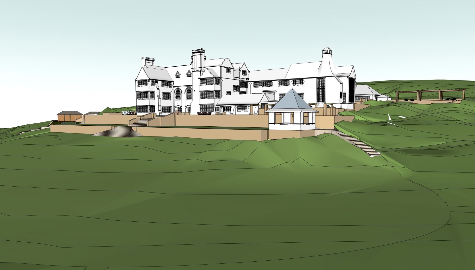
It's a practical, step-by-step guide to mastering complex site modelling techniques, working through several real-life examples of increasing complexity. We walk you through the entire process, from importing raw DWG surveys to converting them to terrains onto which you can carve out spaces for new hardscaping using both native SketchUp tools and a range of extensions.

You'll also learn how to tackle complex intersections as well as sculpt organic landforms, berms, and hedges from scratch.

Whether you are dealing with a gentle gradient or a tricky hillside, you will leave with the skills and confidence to accurately model real-world sites and elevate your design presentations.

You'll of course get detailed notes on all the tools and techniques covered, as well as access to an exclusive forum to get any questions going after the session has finished.
Course Objectives:

  • Import and process real-world site data, including DWGs, contour lines, and PDFs into useable terrain models
  • Build custom terrain models from scratch using SketchUp's native Sandbox tools as well as extensions
  • Seamlessly embed hardscape elements, paths and steps into uneven topography using the Drape and Stamp tools 
  • Master the Draw From Contours command to create complex forms from scratch
  • Construct organic landforms, such as berms and mounds, to bring natural realism to your 3D designs
Write your awesome label here.

Is this course for me?

  • "What prior knowledge does this require?"

    This course requires a good working knowledge of SketchUp, specifically how geometry is formed and of Tags. We expect students to be at the level they would after our Introduction to SketchUp course (and a good few weeks or months of practise!). If in doubt just ask.

  • "Site surveys baffle me"

    It's fair to say that at the start they baffled everyone, present company included! They're something you get used to over time. For this course it would be helpful if you feel reasonably confident in interpreting the numbers on a survey and figuring out from a flat drawing what the ground may look like, but your instructor can guide you and at the end of the day it's not a course on surveys but on building what's in them so you can better interpret the data they contain.

  • "Will this help me actually build things like retaining walls and sunken patios into the slope?" 

    These are the exact things that this course will help you with. We'll build a terrain and then put hard (and soft) landscaping into it.

  • "Do I need to buy the extensions before the course?"

    No. We'll tell you what they are on the portal once you've purchased, and you can choose whether to install a trial version or just watch the section and then try them out in your own time. We mainly focus on native tools - extensions save time but the native tools are just as powerful.

Course Syllabus

1: Getting Ready to Go


  • Reminder on Groups and Components 
  • Hidden Geometry (and Objects) 
  • Geolocation 
  • Extensions
  • Where to find extensions
  • Installing extensions

2: Creating Terrain From Scratch


  • Enabling the Sandbox tools
  • Drawing with the Sandbox “From Scratch” tool
  • A note about complex surfaces in SketchUp (and hidden lines)
  • Manipulating terrain with the Smoove tool
  • Further smoothing the terrain
  • Soften Edges - Remove the grid and smooth the terrain further
  • Alternative ways to create terrain 1 - Soap Skin & Bubble
  • Alternative ways to create terrain 2 - Sandbox > From Contours
  • Alternative ways to create terrain 3 - The Artisan Toolkit
  • Alternative ways to create terrain 4 - Geolocation
  • Navigate the model space with Orbit, Pan and Zoom
    Understand SketchUp basics: edges, faces, inference, and axis locking
  • Use the essential drawing tools to create clean 2D shapes ready for 3D modelling
  • Complete a short example project to start building confidence

3: Creating Terrains From Source Data


  • A reminder (the second time)
  • Importing a DWG
  • Terrain from 3D contours
  • Terrain from 2D contours
  • Terrain from 3D spot heights
  • Terrain from 2D spot heights
  • Drawing up your own survey
  • Working with a PDF (and no DWG)

4: Drape and Stamp


  • Stamp tool
  • Drape tool
  • Different methods to make a road
  • Simple example of Stamp and Drape on a terrain

5: More complex forms


  • Intersect Faces With Model - Simple Example
  • Intersect Faces With Model - Complicated Example
  • Taking this further…
  • General tips and troubleshooting for Intersect Faces With Model
  • Mounds, berms etc. - examples

6: Workflow


  • Creating a garden on a sloping site 

Testimonials

At last, VW help and training that is relevant and evolved to work for us, correct our errors, expand our knowledge and make us more efficient in an understandable and easy way. Thank you, we're looking forward to coming back for more nuggets of wisdom and practical tips and planning future courses with you both.
HARRIET PARSONS LANDSCAPE ARCHITECT
We used Digital Landscapes to develop our Vectorworks skills under the excellent tutorship of Fiona. Her flexible approach and deep technical knowledge proved invaluable to our bespoke requirements. Thank you Fiona!
GEORGIA @ LANDSCAPE ASSOCIATES
Created with